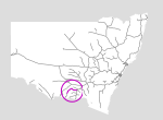
Oaklands Branch
Summary
| Track: | 124.29 km |
| Stations: | 1 / 14 in use |
The Oakland Branch lies in the south of the state, starting from the township of The Rock, on the Main South Line, and extending west and south to the small town of Oaklands. At the current time, the line still being used as far as Boree Creek for the transport of grain.
From Oaklands a broad gauge line extends south into Victoria via the border town of Mulwala. This section is operated by V/Line trains.
| Name | Facility | Status | Opened | Closed | km | Links | ||
|
|
The Rock | Station | In Use | 1-Sep-1880 | - | 550.290 | 18 | |
|
|
The Rock ABA Terminal | Other | In Use | unknown | - | 3 | ||
|
|
Tootool | Station | Closed | 8-Jul-1901 | 4-May-1975 | 561.720 | 4 | |
|
|
French Park | Station | Closed | 8-Jul-1901 | 4-May-1975 | 569.268 | 3 | |
|
|
Milbrulong | Station | Closed | 8-Jul-1901 | 4-May-1975 | 576.990 | 6 | |
|
|
Napier | Station | Closed | 8-Jul-1901 | 2-Dec-1967 | 583.378 | 1 | |
|
|
Lockhart | Station | Closed | 8-Jul-1901 | unknown | 589.040 | 11 | |
|
|
Long Park | Platform | Closed | 12-Dec-1910 | unknown | 600.960 | 3 | |
|
|
Boree Creek | Station | Closed | 12-Dec-1910 | 4-May-1975 | 606.700 | 8 | |
|
|
Yuluma | Station | Closed | 12-Dec-1910 | 4-May-1975 | 619.235 | 2 | |
|
|
Cullivel | Station | Closed | 9-Dec-1911 | 4-May-1975 | 634.850 | 2 | |
|
|
Urana | Station | Closed | 9-Dec-1911 | unknown | 647.690 | 8 | |
|
|
Uranagong | Station | Closed | 23-Dec-1912 | 1950 | 656.632 | 3 | |
|
|
Coorabin | Station | Closed | 23-Dec-1912 | 4-May-1975 | 666.740 | 6 | |
|
|
Oaklands | Station | Closed | 23-Dec-1912 | unknown | 674.580 | 18 |
Summary
| Track: | 124.29 km |
| Stations: | 1 / 14 in use |
| Section | Opened | Closed | Usage | ||
| The Rock - Lockhart | 8-Jul-1901 | general | |||
| Lockhart - Boree Creek | 12-Dec-1910 | general | |||
| Boree Creek - Yuluma | 12-Dec-1910 | 11-Nov-1988 | 1 | general | |
| Yuluma - Urana | 9-Dec-1911 | 11-Nov-1988 | 1 | general | |
| Urana - Oaklands | 23-Dec-1912 | 24-Nov-1982 | 2 | general |
2 Last train ran 3-Aug-1977